
Select your language
")
")
")
")
Blog 1: The Bermuda wrecks on postage stamps
In 1986, Bermuda issued a three-part stamp series depicting seventeen shipwrecks – traces of a long and risky seafaring history in the western Atlantic.
The Bermudas cover little more than twenty square miles of land – a tiny dot in the Atlantic that nonetheless played an important role in seafaring in the 16th century. Spanish galleons used the island group as a landmark on their journey home.
While latitude could already be determined fairly reliably using the sun and stars, longitude remained an unsolved problem. A single navigational error was enough for a ship to head inexorably towards the shallow coral reefs off the islands.
The stamp series pays tribute to this maritime past and shows some of the best-known wrecks that lie along the reef zones around Bermuda.
Anyone who has solved the puzzles in the other blog posts will find familiar points of reference here: the names of the ships can be clearly assigned using the “wrecked” date from the article “Why so many wrecks”.
The ship on the yellow stamp is also listed there – a subtle hint for anyone who wants to keep on puzzling.
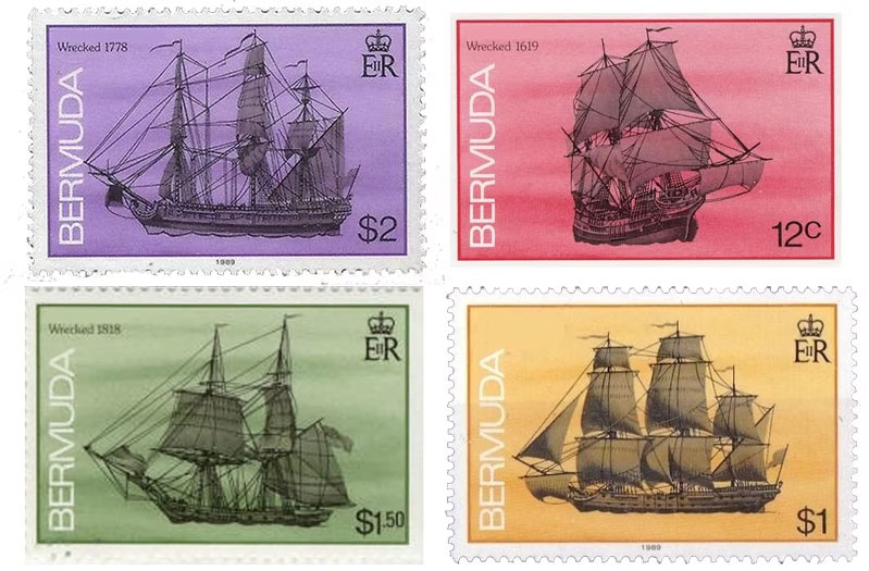
The Bermuda wreck stamp series
Match the descriptions to the wrecks
The four coloured stamps show brief descriptions of the wrecks – without revealing their names. Assign all stamps to the slots and then check your solution with a click.
After my last visit to the Swizzle Inn, I got talking to an art expert after we’d had a few beers. I had his email – but the note is torn.
This is the part I managed to find:
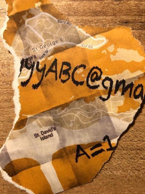

You have found coin .